GeoSpatial Infrastructure
Infrastructure Issues are in the forefront of reinventing society. While traditional infrastructure is crumbling and needing significant societal investment and government support, new forms of infrastructure are being developed and build using information and communications technologies "moving" and facilitating knowledge as commodity and value-added product and services.
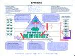
GeoStrategis provides consulting services to develop the strategies, prioritize innovation objectives, reduce barriers to manage the development and implementation of spatial data and knowledge Infrastructures.
This includes geospatial infrastructure development in support of:
- Data Management and integration
- Knowledge systems
- Enterprise systems
- Policy Systems
- Societal participation systems
- Converging technologies influencing the systems of the future
- Geospatial value-adding chain
Projects:
- SDI blueprint Canadian Forest Service
- Migration From Spatial Data to Spatial Knowledge Organization: Canada Centre For Remote Sensing
- Evolving Business Model Scenarios for CEONet- Canadian Earth Observation Network
- A demand, issue and science based approach for The National Atlas Information Service, Canada
- Exploring the developent of a Geosopatial Knowledge Infrastructure
- Faciliating the development of an Arctic Geospatial Data Infrastructure (ASDI)
The GeoNorth Conference inluded a number of sessions exploring the dimensions and development of a Arctic Spatial Data Infrastructure (ASDI). Jean Thie of Ecoinformatics International facilitated a special session to develop a road map for the ASDI.
Panel Members included:
- Barbara Ryan and Doug Nebert, USA
- Roy Mellum, Norway
- Jarmo Ratia and Heli Ursin, Finland
- Per Syren, Sweden
- Lola Bahl, Denmark
- JeffLabonte, Canada
- Fraser Taylor, Canada